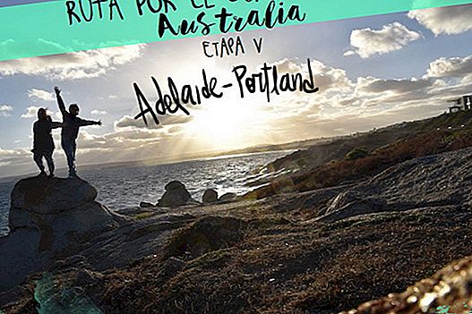
Finishing the second week of ourroadtrip through southwestern Australia by van we will pass through historic oil platforms and rivers, we will contemplate spectacular sunsets (maybe with Charlie Harper), we will freak out with giant lobsters and killer wasps and we will end up meeting a nice little animal ... This is our fifth stage of the trip. You can see the other stages in these links: Stage 1 / Stage 2 / Stage 3 / Adelaide / Stage 4.

At the moment these are the main data:
Stage Information
Point: Adelaide
Final point: Portland
Total km: 783 km
Days: 3 days
- Day 17: Adelaide - Port Elliot (103 km)
- Day 18: Port Elliot - Pinks Beach (344 km)
- Day 19: Pinks Beach - Portland (336 km)
Day 17Adelaide - Port Elliot
From Adelaide we follow the coast road, passing through some beach towns like Glenelg. It was Sunday morning and the atmosphere was fabulous. We stayed a couple of hours in the sun, reading and enjoying the van again. It was a day without hurry because we were separated less than 100 km from our next destination: Port Elliot.
The town of By Elliot, whose population does not reach 2,000 inhabitants, is a perfect place to find tranquility and calm. Walking through its deserted streets we imagine in 30 years spending our jubilee life in a place like this. But the time has not yet come. It is a place with history, was founded there by 1850 and retains many old buildings. To visit them, two walking itineraries are proposed that pass through the center of the town: the red walk and the blue walk (or together, the Port Elliot Heritage Trail). Some of the emblematic buildings are the Hotel Elliot (1868), the Council Chambers (1879), the Library (1880), the Court House (1866) or the police station (1853).
→ Download the map with the proposed walking routes
What we really enjoyed was the sunset from the rocks on a beautiful beach. Something that usually happens to us is that suddenly we have the same thoughts, many times without coming to mind. Here it happened again, each of us looking on the horizon as the sun set, imagined on Malibu beach and thought he saw Charlie Harper leaving his mansion to take a bath ...


Here we stayed at the Port Elliot Beach House YHA of the YHA hostel chain. And it's a pass! This is an old hotel restored as a hostel, with views over the ocean from the stunning terrace! We can only say that an egg is cool! Also Richard, the manager, is a crack!

- Prices: from $ 30 per night per person.
- Location: 13 The Strand
Day 18Port Elliot - Pinks Beach
The 18th day of roadtrip is the day we saw a giant lobster! If Route 66 has its giant whale, the route through southern Australia has this. But let's go in parts ... If you want to go from Port Elliot to the south, you will have to make a detour because in the area where the Murray River flows, marshes form where there is no road. So the solution is to climb upMurray bridge. Here it is very popular to rent a boat among families and go out for a few days to explore the river (eye that some have until jacuzzi!), But also the excursions of a few hours. We who were only in passing went to the Murray Bridge Bunyip to have beautiful views of the river and the historic railway bridge that crosses it.

Returning to the southbound road, go through another attempt at Pink Lake (neither pink and almost nor lake) and you will reach the coastline that leaves on the right allCoorong National Park. The area we are going through is famous for being the site where Australian oil industries began to operate. In 1866 a Petroleum platform in the place where, a few years before, he found what appeared to be an oil spring. After years of extraction it was recognized that it was nothing more than a “substitute” composed of algae that they called “coorongite”… Today a replica of that structure can be seen in the vicinity of Salt Creek.

Apparently it is also a place where hundreds and hundreds of Chinese in the mid-nineteenth century, attracted by the idea that in Australia the mountains shone with huge amounts of gold, hardships came and, I guess, some of them to get rich . There is an area where they tell you a little history, with informative signs and some historical places.
But beware, here comes our friend, the great protagonist of the day, neither oil nor gold! Here the queen is her. When you are arriving in Kingston, open your eyes wide, because on your left you will make your way to the sky, shading the trees, giant lobster! With the rush of adrenaline after seeing such a monument we could not continue driving, so we continued along the road that reaches Pinks Beach and camped that night there, next to some somewhat guarded bathrooms and a cool beach where to contemplate the sunset, do you can you ask for anything else?


Day 19Pinks Beach - Portland
This day was the last in the state of South Australia, the day we started brushing our teeth in a bathroom surrounded by brown worms and we ended up with a beer in our hands watching as a koala climbed to the top of a eucalyptus to enjoy the cooler leaves ... But during the day there were few things that surprised us. Let's go to the mess.
After leaving our free Pinks Beach campsite we headed to the town of Steal. Without even having stepped on it, we already knew that it would not disappoint, a town that is named after the singer of Extremoduro has to be cool, sure! And he ground! We climbed up to the cliff where the obelisk is, with sublime views, and stopped at the ruins of an old jail, of those that hosted the prisoners of British lands.

Beachport It was the second stop of the day, this town boasts an incredible scenic road, about 8 km (the last on unpaved road) that passes through different virgin beaches, of which we highlight the Salmon Hole. We continue a little to the blowhole (which at low tide was not blowhole or na) and the Salmoe Pool, a small lake with picnic tables and where to take a bath if you are more freshwater than salty. The road, although not in a loop, is worth it.

Pulling to the southeast in the middle of the road we find a point marked with the suggestive name of Fossil Cave Hole, the suggestive stayed there. It would have been more interesting if a snake had greeted us because the place has nothing! Although it was a good time to stretch my legs a little on the way to Mount gambier, the largest population in this area and with a couple of places or three to highlight.
The first one was the Dominos Pizza ... the second a viewpoint over the Blue lake Where to eat the $ 5 pizzas. If at that time the important thing was pizza, the Blue Lake has the power to concentrate your gaze on its deep blue waters, making the rest of the trivialities of a poor backpacker secondary. The lake is nothing more than an extinct volcano, with stunning blue waters. There is a road that runs along the top of the crater, leaving one lake the fall into the volcano, and the city under Mount Gambier under your feet.

The last attraction of the place is the Umpherston Sinkhole, or translated: "the sink of Umpherston". This is another hole in the earth, okay, but quite spectacular. Formerly it was a cave formed by the erosion of the waves of the sea, until the roof by its own weight collapsed, leaving all its shame outdoors. Now they have turned it into a beautiful park of hanging plants and malicious wasps.

We did not say it in the entry of the article, but today we will also remember them for having been in the southernmost point of Australia, "only" 5,700 km from the south pole. Such a place has a geographical character, it does not have to be beautiful or offer anything interesting, beyond its position. However Australia is different and even here you can freak out with some very cool cliffs and, if you come at the right times, with a penguin colony. That is, at sunrise or sunset.
The closest population to this place is Port MacDonnell, from small houses on the beach, with a strangely lively port and a mural of notable dimensions. But it is also that this town was the first settlement of the state of Victoria.

When we see a narrow road in one of the map apps we use, the funk is coming. And it is that traveling in a van like ours in Australia, where every two by three you find unpaved roads and bumpy roads, makes you prudent. This was the feeling we had when marking our next destination: a road drawn with a narrow white line on Google Maps used to not be good news. We are wrong: this route is a scenic road of about 15 km that leaves the coast on the right and runs through beautiful meadows, fields with nice cows and little, very few people. It is called theEight Mile Creek Road. We considered staying at a free campsite with a good looking look, but we read a comment on the Wikicamps app that said it is an area where tiger snakes tend to be at ease and what you want me to say, we are young to die.

When we left the road and joined the main road, we didn't have many kilometers to reach our destination: Portland. But this is already in the state of Victoria, so we went back through a new imaginary line, this time the one that separates the states of South Australia and Victoria. Perhaps with so much travel we are already going half crazy, but it gave us the feeling that the landscapes changed completely, from an area of low shrubs dotted with eucalyptus, we went to more closed pine forests and number of kangaroos in the gutters (and occasional jumping). So not only did the time change (here the clock is advanced half an hour).
We leave the Portland visits for the next day, for now we are entertaining ourselves with the Koala that goes up and down the branches of the tree in front of our campsite, praying that it does not fall, or that if it does so unless damage is done.