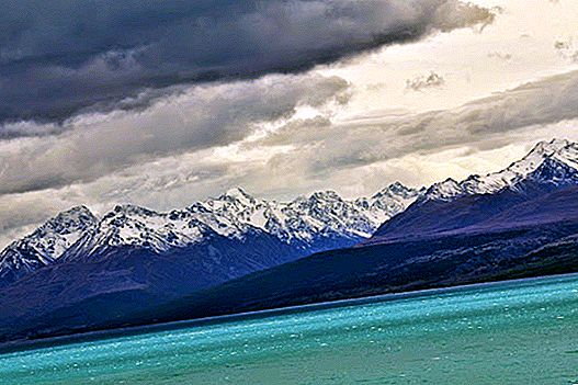
From a distance, seen from Lake Pukaki, Mount Cook rises imposingly on the horizon above its little brothers in the New Zealand Alps. Not in vain, Mount Cook, or Aoraki In Maori, it's the highest peak in all of New Zealand, with more 3,700 meters. We did not want to miss the chance to get closer to him and see if from his feet he really imposed so much, so that was our next destination.

The road that runs 50 km between Lake Pukaki and the little village mounted in the vicinity of Mount Cook (simply called Mt Cook Village) It is already a real show in itself. It may be one of the most beautiful panoramic roads we have traveled throughout the country. Of course, every time we went out to take a picture, a cold nose hit us, so we prefer to enjoy the views from inside the car.


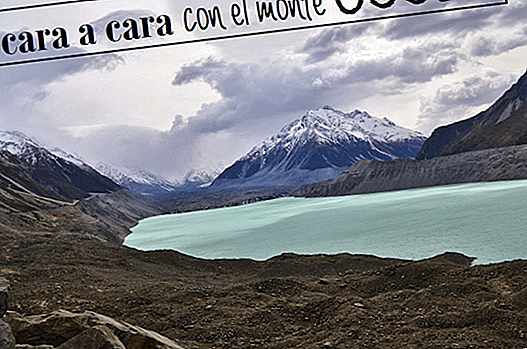
A few kilometers before reaching the town there is a turnoff to the left that leads to a shelter on a gravel road for 8 km. It was our first stop. From here some roads leave to see the splendid views of the Tasman valley and of Tasman Glacier and Lake. There is also a small route that reaches the Blue lakes, although they had little blue ...


We drove what was driven and we arrived at the small town, which is practically four half-shabby accommodations and a piece of hotel, the Hermitage, with many stories of mountaineers since it opened in 1884. But the important thing is the tracks that leave from here and travel the valleys of this mountainous massif. One of them (possibly the most famous) is that of Hooker valley until the Hooker Glacier. The road crosses this valley following the river that rises in the glacier with the same name, always having Mount Cook as a reference point. Or at least we assume that on the day we were dense clouds covered the whole panorama, so we could only intuit it ... even so we enjoyed it to the fullest, the environment is spectacular!


USEFUL INFO
Tracks:
- Tasman Glacier and Blue Lakes: departs from the Blue Lakes Shelter. To arrive you have to deviate a few kilometers before reaching the town on the right and travel a gravel road for 8 km. Once there, there is a path that goes up a hill and then divides into two, right towards Lake Tasman and the glacier and on the left towards the Blue Lakes. Both are easy roads and are traveled in about 10 or 15 minutes.
- Hooker Valley: past the town is the campsite of the DOC "White Horse Hill", for a fee. From there the walk through this incredible valley towards Mount Cook, until you reach the glacier. The route is simple, crossing several bridges over the Hooker River. In total they are about 5 km that are made in an hour and a half approx. Calculate about 3 hours in total round trip. More info here.

Sleep: We do not stay at Mt Cook Village because there are no free campsites, we return to Lake Pukaki.